
GEOFLOW
The Smart Way to Manage Geospatial Projects
From the field to the dashboard – streamline everything in one intelligent platform.
Map-Based Project Management
Visualize and manage projects linked to real land parcels. Track project status, location, and progress directly from the map interface.
- Search addresses
- Drop project pins
- Change project statuses on the fly
- Filter by location, job number, or status
Employee & Contractor Management
Add, track, and update employee or contractor records with full control.
- Define custom roles: Admin, Technician, Field Crew
- Log attendance with check-in/out tracking
- View total hours worked
- Maintain SSNs, contact info, addresses, and contractor types
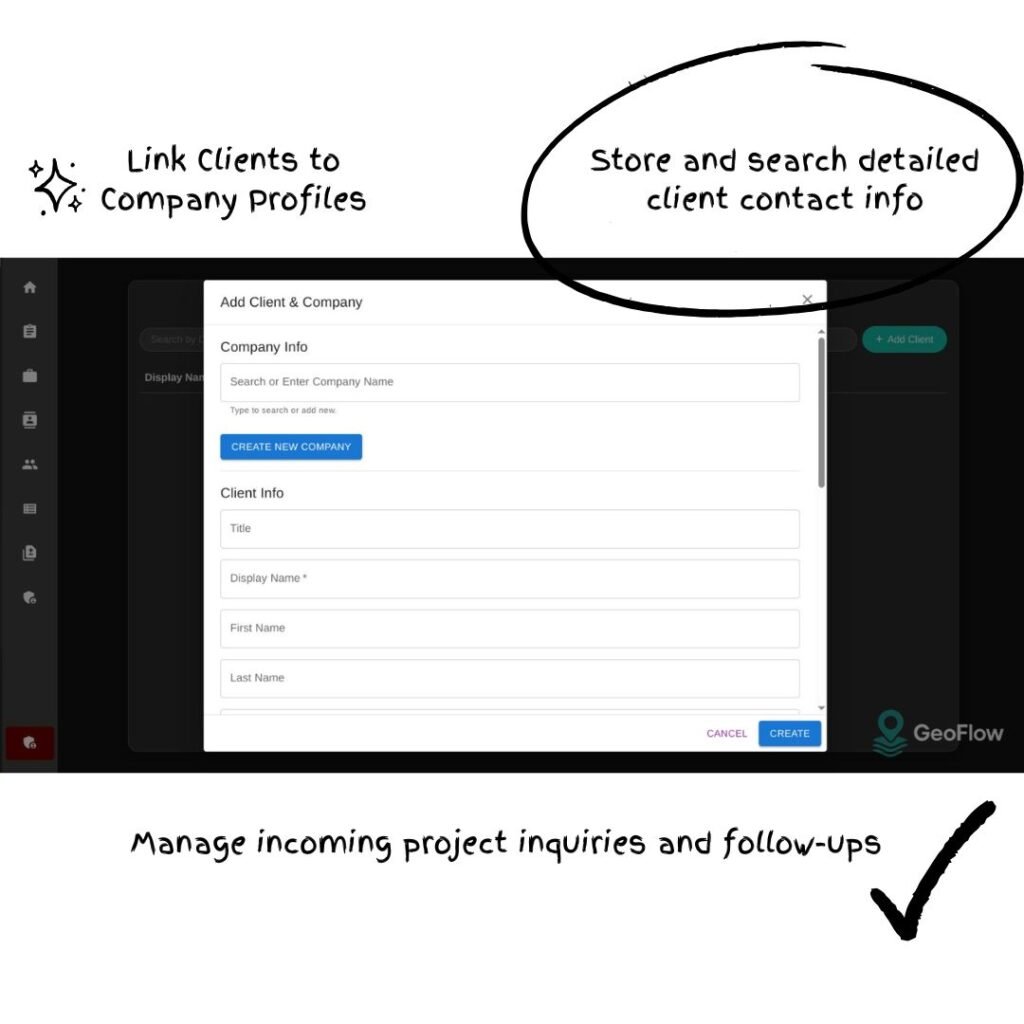
Client & Inquiry Tracking
Easily onboard clients and log their project inquiries from a simple interface.
Smart Admin Dashboard
One glance gives you everything.
- Real-time project status distribution
- Daily hours logged by team
- Quick insights into resource load and team activity

AI-Powered Search & Automation (Coming Soon)
Accelerate operations with built-in AI assistance.
- Natural language search: “Show me all pending fieldwork in Austin”
- Auto-suggest project locations from map context
- Intelligent matching of clients, parcels, and projects
- Predictive status updates and risk alerts
Power your geospatial workflows with GeoFlow.
Try the future of project management, today.