
Analyzing Seasonal Dynamics in KPK
Tools
QGISSkills & Knowledge Gained
- Advanced geospatial data visualization and thematic mapping in QGIS
- Spatial analysis of climate variability and seasonal trends
- Multidimensional integration of temperature, precipitation, and solar radiation datasets
- Interpretation of environmental and meteorological data for regional climate visualization
This project investigates the climatic patterns in Khyber Pakhtunkhwa (KPK), a region in northwestern Pakistan characterized by a diverse topography—from high mountainous areas to vast plains. By analyzing datasets spanning several decades (1970–2000), the study examines seasonal variations in temperature, precipitation, and solar radiation. This analysis provides a basis for understanding local climate dynamics, which is critical for both environmental studies and regional planning.
Mapping Average Temperature
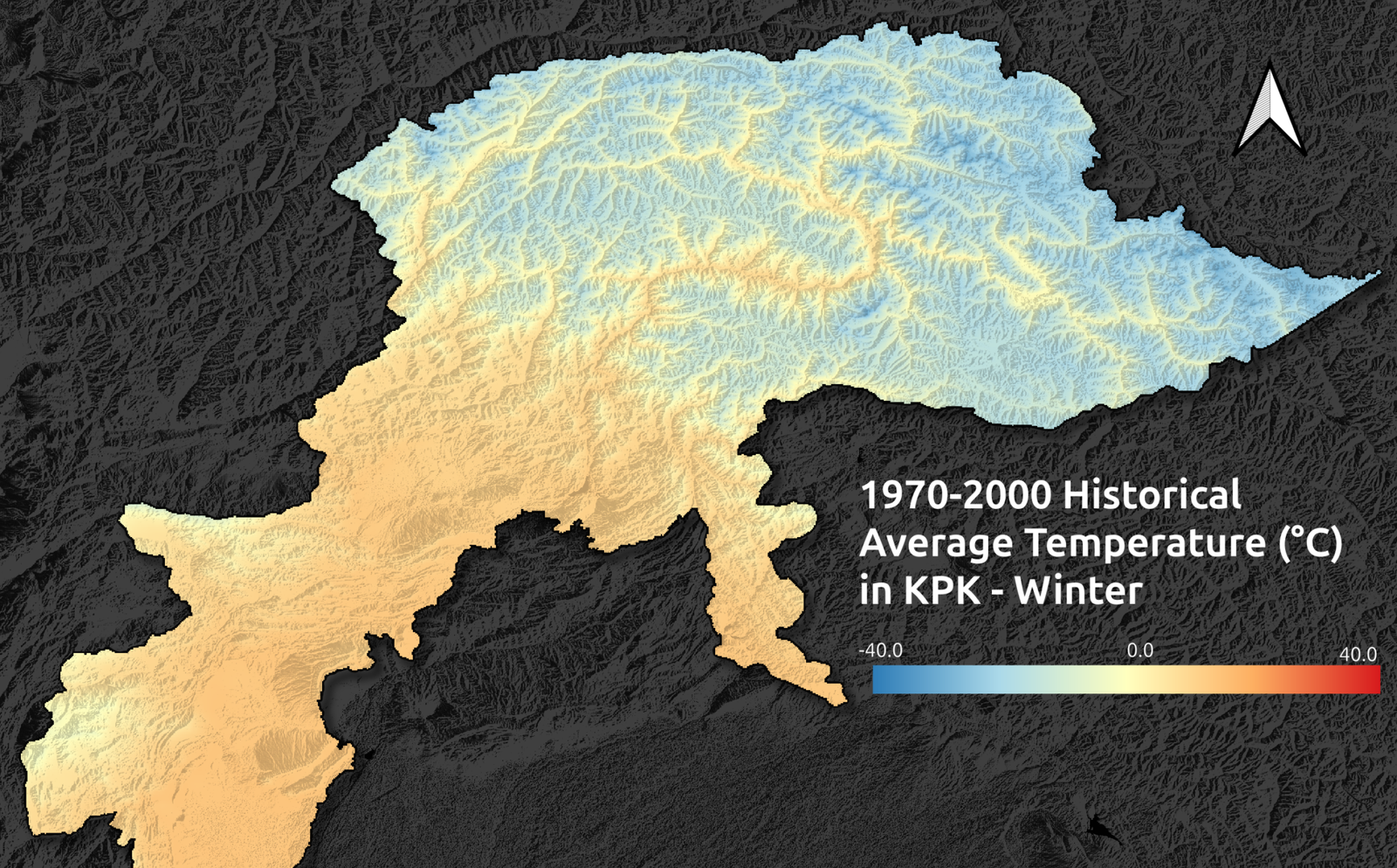
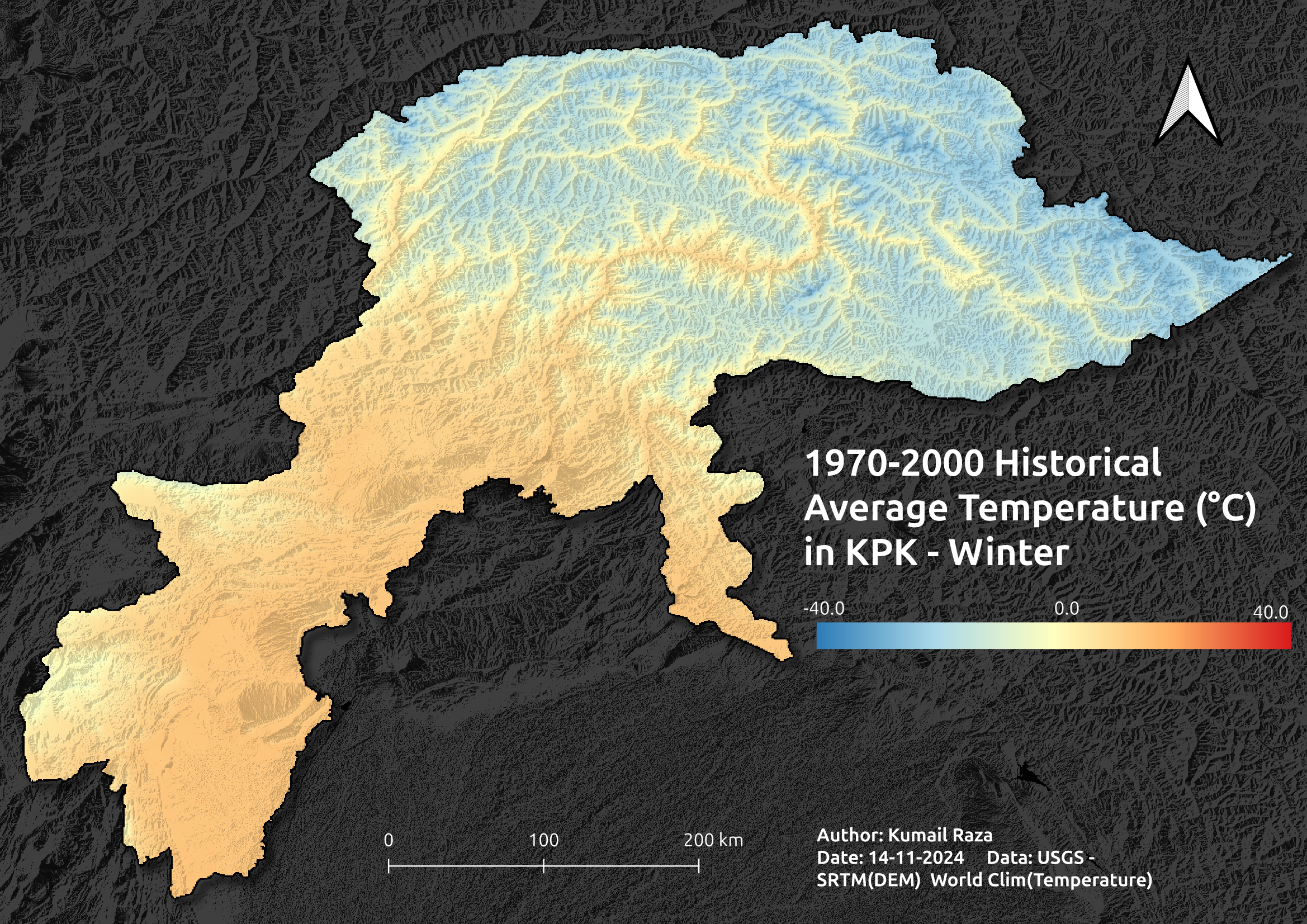
The initial phase focused on creating an animated time series of the average temperature to capture seasonal fluctuations. Data visualizations highlight that during winter, the mountainous regions exhibit significantly lower temperatures—illustrated in cooler blue hues—whereas in summer, the lowlands experience elevated temperatures, depicted with warmer tones.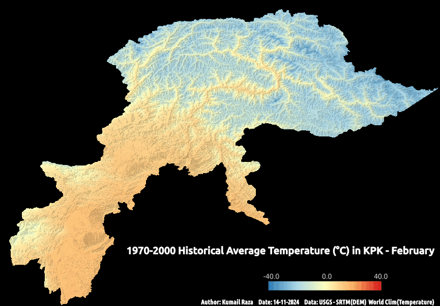
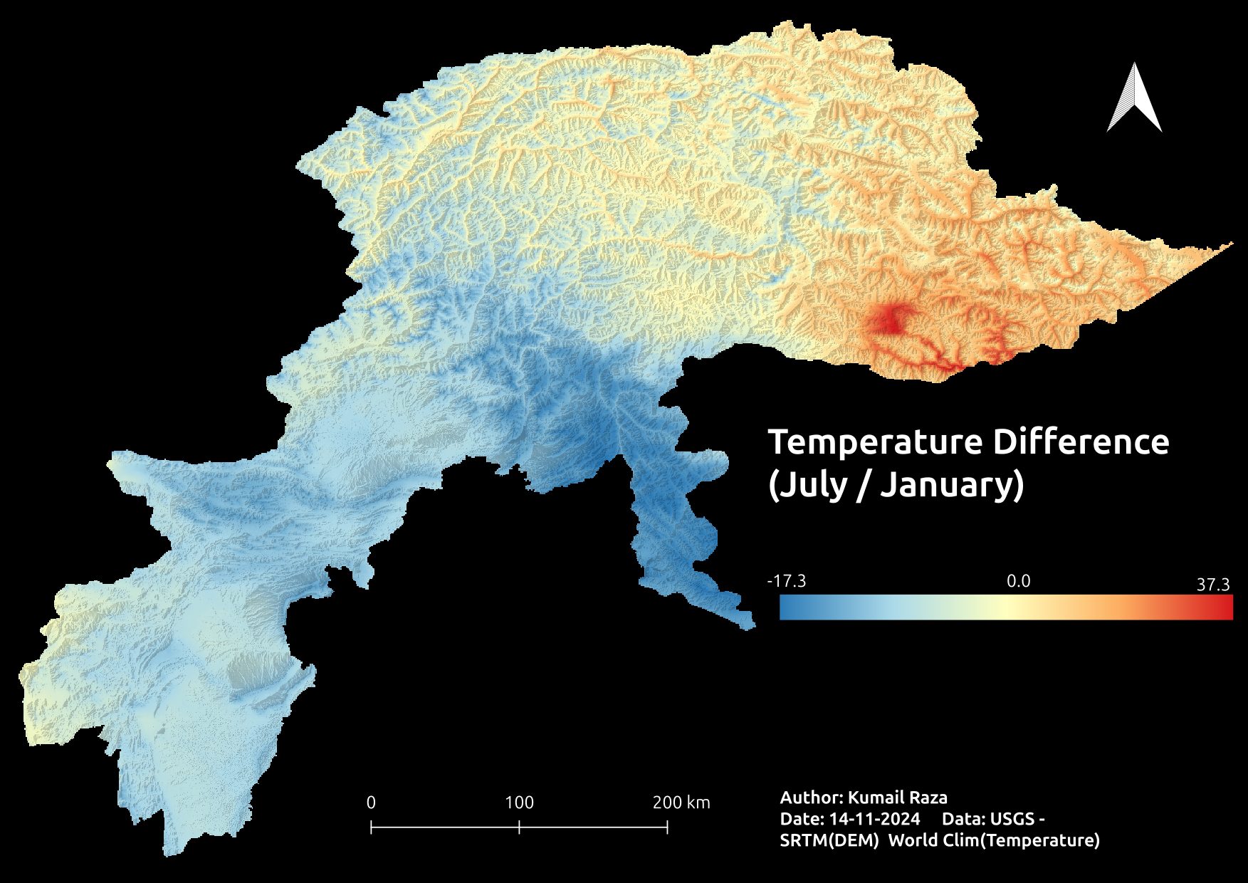
Seasonal Temperature Distribution
Detailed thematic maps were generated to analyze temperature distribution. The winter map reveals that the northern mountainous regions maintain consistently low temperatures, while the summer map demonstrates a pronounced thermal gradient, with deep red areas in the southern plains indicating intense heat. This contrast provides insight into how altitude and geography modulate seasonal climates.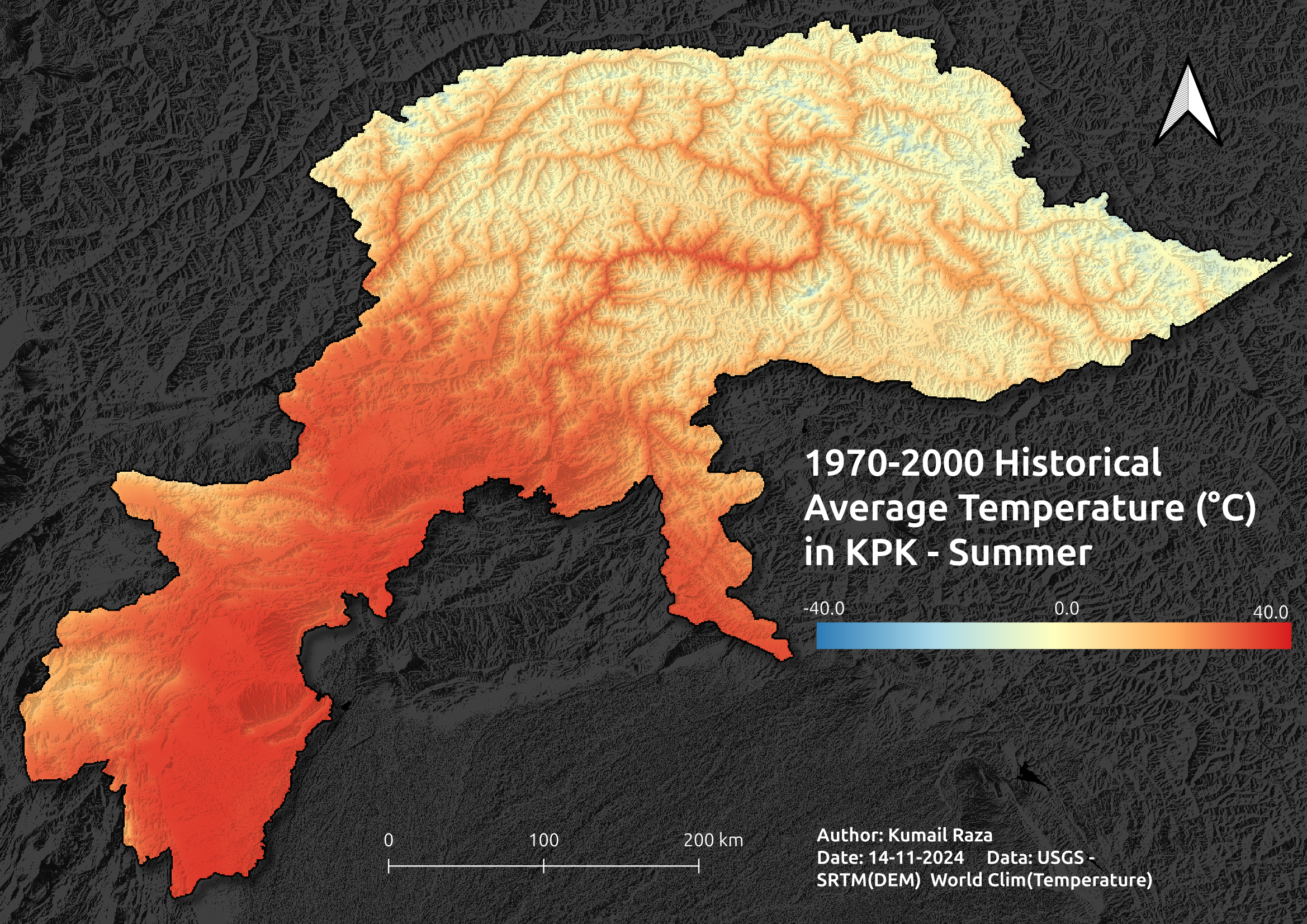
Mapping Precipitation Patterns
The precipitation analysis employed average monthly rainfall data to delineate regional rainfall patterns. The resulting maps demonstrate a gradual increase in rainfall from March, with a pronounced monsoon signature during July and August. Such patterns are critical for understanding water availability and for planning in sectors like agriculture and water resource management.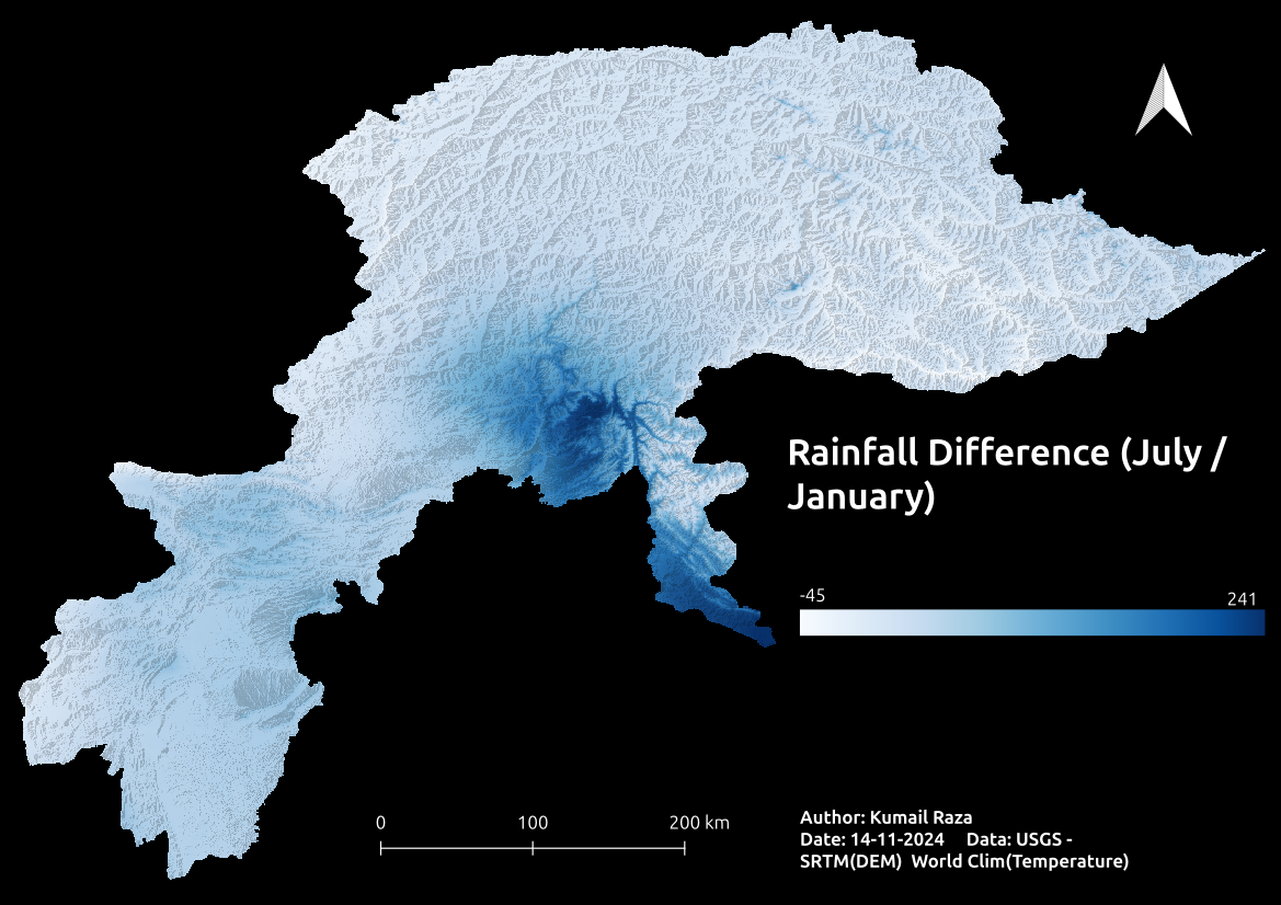
Seasonal Contrast: Rainfall and Temperature Differences
By juxtaposing the seasonal maps, significant disparities emerge between summer and winter. Areas exhibiting high summer temperatures (warmer red) coincide with regions experiencing marked differences in rainfall intensity. This comparison underscores the strong interplay between temperature and precipitation, which is influenced by both geographical features and seasonal meteorological phenomena.
Assessing Total Solar Radiation
The study also evaluated the spatial distribution of solar radiation across KPK. Observations indicate that the southwestern and southern zones receive significantly higher solar radiation, likely due to reduced cloud cover and lower altitude effects, whereas the northern mountainous regions receive considerably less. These findings are instrumental for renewable energy applications and for understanding regional energy balances.
Visualizing Global Climate Trends Over 2023
This project developed a time series to visualize global climate patterns throughout 2023. The analysis includes data from all months, highlighting seasonal shifts and temperature variations across different regions of the globe. The visualization reveals how global temperatures fluctuate with changing seasons, showcasing warming trends in specific areas while identifying cooler patterns in others. These insights provide a clearer understanding of climate dynamics and their impact over the course of a single year.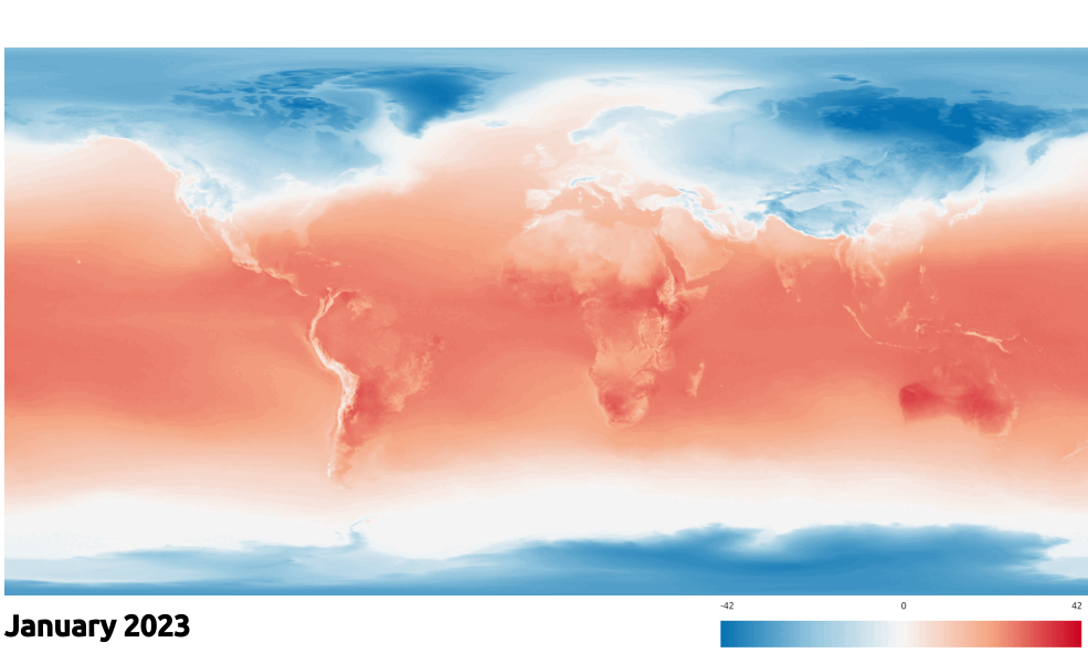
Dive deeper into the comprehensive analysis in the full report.